blah blah blah
The Meader Ridge
Length: 11.1 miles out-and-backDifficulty (click for info): Very Hard
Elevation Gain: 2450 feet (+520 feet on return)
Rating (click for info): 9/10
Elevation: 3030' (Eagle Crag), 2888' (Walker Ridge), and 2782' (Mt. Meader)
Prominence: 80' (Eagle Crag), 138' (Walker Ridge), and 112' (Mt. Meader)
Driving Directions:
Trailhead and parking area are on Wild River Road in Bean's Purchase, NH. Wild River Road leaves the west side of Maine Rt. 113, 3.2 miles south of Rt. 2 in Gilead, ME and 12.3 miles north of Rt. 113B. Travel 5.7 miles down Wild River Road, crossing back into NH, and turn left into a parking area for the Wild River Campground. Click here for a Google Map.
About the Hike:
Of all the famous ridge traverse hikes in the White Mountains, the Meader Ridge... isn't one of them. The Meader Ridge is a fairly unknown name among White Mountain hikers. It's hidden away in a rather remote area of New Hampshire, extending north from the Baldfaces close to the Maine border. Most famous White Mountain ridge traverses derive their popularity from seemingly endless open ledges with wide views. The Meader Ridge traverse isn't about that; viewpoints are more sporadic as the ridge is mostly wooded, and it's an out-and-back hike - instead of walking the ridge in one direction and descending a different way than you came up, you must retrace every step you take. So what exactly is the allure of the Meader Ridge? It's the sheer variety of scenery you will experince both while walking the ridge and on the way there. The ridge crest itself features a variety of interesting forest environments, from sub-alpine openings to thick spruce forest to bogs and marshes. While the views aren't continuous as you hike, the viewpoints you will encounter along the way are quite spectacular and offer unique views of the Evans Notch and Wild River Wilderness regions. Not only that, each of these many fine viewpoints offers something different from the others. On the way up to the ridge crest, you will discover a wild and scenic gorge which features many cascades and views of cliffs looming overhead. Additionally, two of the points on the ridge, Mt. Meader and Eagle Crag, have status on the 52-With-a-View list, although they are combined into a single entry.
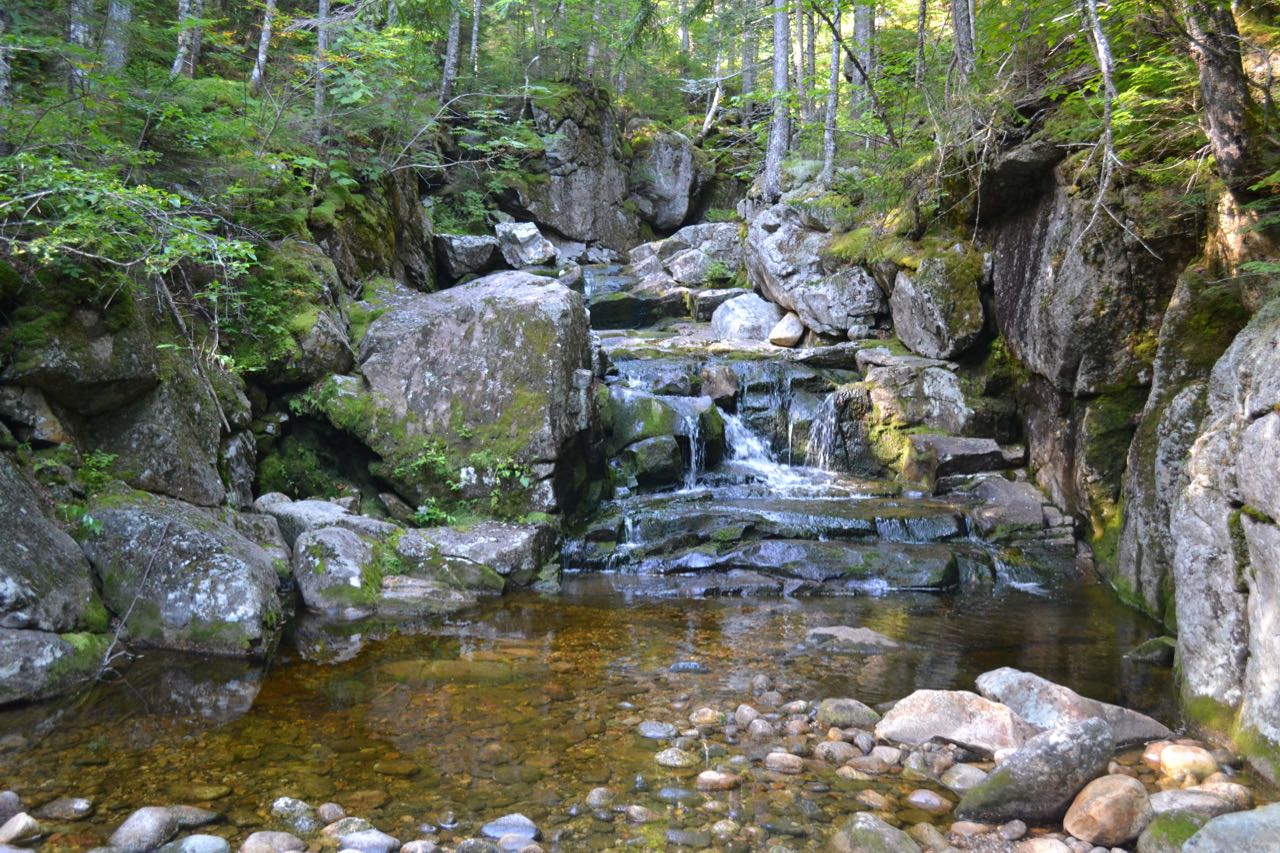
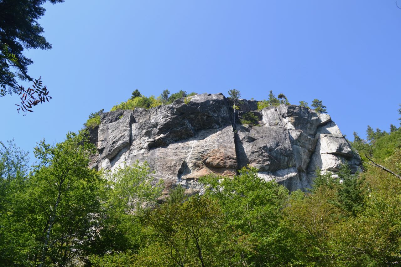
The approach to the ridge begins from the north; after driving in nearly six miles on Wild River Road, you are deep in the Wild River Valley. Start your hike on the Basin Trail, which leaves the east (left, from the direction you drove in) side of the parking area. The trail wanders through the valley forest for 0.4 miles, using a section of an old woods road. It then bears left and crosses a marshy area over bog bridges. After another 0.2 miles over flat terrain, the trail comes within sight of Blue Brook, which you will be following almost all the way to the top of the ridge. In the next tenth of a mile, the trail crosses a smaller brook across the hillside, then passes an opening at the brookside, before pulling back away to parallel Blue Brook at a distance. The trail leads across the hillside above the brook for the next 0.7 miles, never straying too far away, until it makes a short descent to cross the brook at the base of an interesting gorge filled with rapids and short cascades. On the other bank, the trail closely follows the brook through a scenic, ledgy area, where there are more oppotunities to venture out to the edge of the gorge to view the rushing brook. After 0.3 miles on the east side of the brook, the trail passes directly beneath a set of impressive cliffs on the slopes of Basin Mountain, right across the brook. There are a few good openings where you can see them in full view. The trail continues for 0.2 miles in proximity to the brook, then bears left and turns away. It climbs for about 1/4 mile up gentle slopes through open hardwood forest to a junction with Blue Brook Connector. Continue straight, staying on Basin Trail, as it climbs for another 0.2 miles to a major five-way trail junction known as Rim Junction. The Basin Trail continues straight across the junction, while Basin Rim Trail crosses it at a right angle. Black Angel Trail comes into the junction at a sharp angle from the right. From where you stand as you approach the junction on Basin, the diverging trails are, in clockwise order from your immediate left: Basin Rim Trail northbound, Basin Trail continuing east, Basin Rim Trail southbound, and Black Angel Trail. To continue your hike toward your destinations, you will need to take the second right onto Basin Rim Trail southbound.
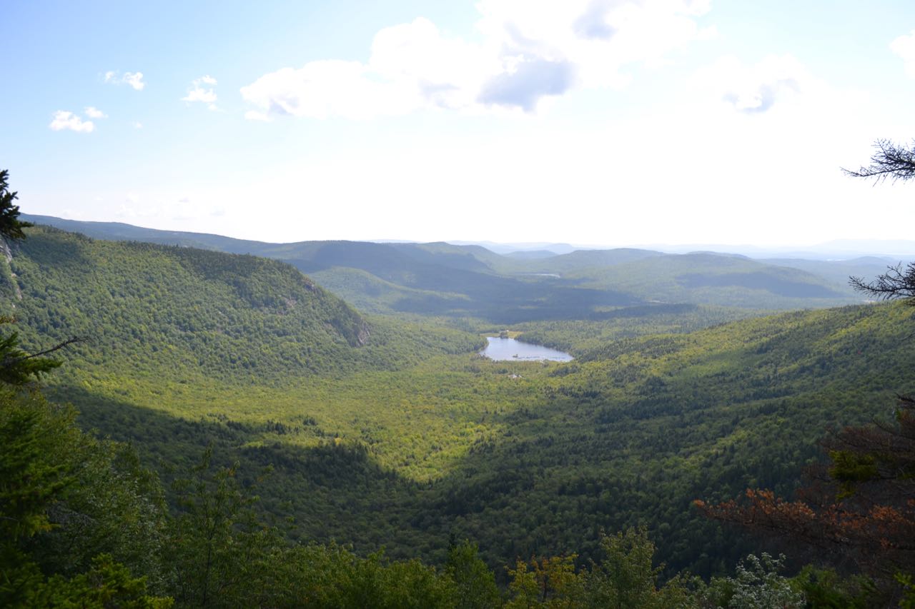
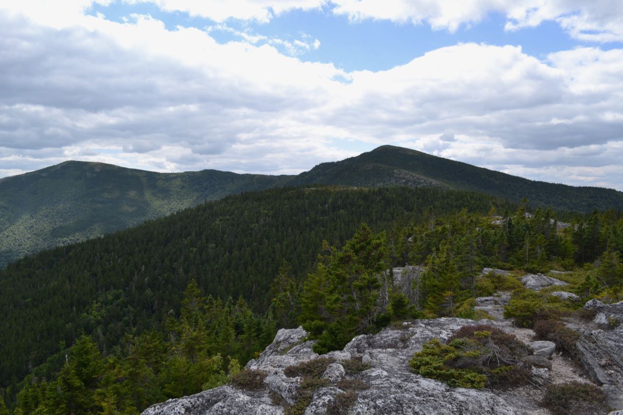
You are now on the crest of the Meader Ridge between Mt. Meader and West Royce Mountain, at a section known as the Basin Rim. The Basin is a huge horseshoe-shaped cirque on the east side of the ridge between those two mountains, in the center of which is Basin Pond. Head just a tenth of a mile down the wild, ledgy ridgetop path and you will be rewarded with an excellent viewpoint over this unusual and impressive mountain formation. You observe the floor of the horseshoe from one end looking out. Cliffs color the slopes of the cirque on both sides of you. Basin Pond rests at the bottom of the great valley in the center of your view. Beyond the end of the valley lie the low-lying Deer Hills across the border in Maine. Continue across the open ledges and drop back down into the forest. Then follow the trail across some less open ledges, reaching a low point 0.3 miles from Rim Junction. The trail swings to the west and heads across mostly flat terrain for 0.2 miles, then begins to ascend the crest of the ridge with short, rapid switchbacks. The switchbacks end after a tenth of a mile, and the trail angles uphill for the next 0.15 miles, skirting around a knob on the ridge named Ragged Jacket. The terrain is rough as the trail takes you above a set of cliffs just out of view. A short descent follows as the trail selects the best terrain to curve around the Ragged Jacket, and the trail continues its sidehill climb, soon swingning away from the knob and crossing a small brook in about a 1/4 mile. The trail then takes aim at the east summit of Mt. Meader, climbing directly uphill through darker spruce forest over much rockier footing. After another 1/4 mile, you reach the first ledges, and the trail continues up over bedrock for the final tenth of a mile to this eastern summit, where there is a trail junction. There are great views here, looking out to the rugged Evans Notch, where you can see the summits of both East and West Royce Mountain, as well as Caribou and Speckled Mountains over in Maine. Basin Rim Trail ends here, and you are now well out to the west side of the horseshoe. Bear right onto Meader Ridge Trail as Mt. Meader Trail comes in from the left.
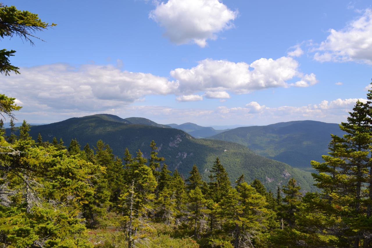
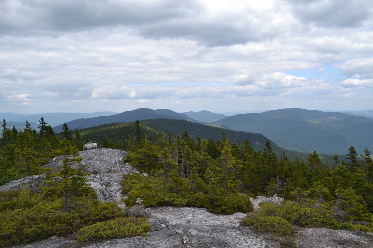
The trail descends gently off the ledges of the eastern knob, then climbs slightly to reach its high point on Mt. Meader in just under 0.2 miles, where you are about 270 feet southeast of the insignificant wooded summit. The trail descends slowly at first, then drops sharply down the side of the ridge and contours across a steep slope, coming out to a break in the trees and another fine viewpoint after 1/4 mile, where you look out to the east at the flat terrain in Maine. Not far beyond this, after a short ascent, look for a sign marking a path on the right side of the trail. This short spur trail leads up to some more open ledges on the west summit of Mt. Meader, where you have a striking view of the nearby Baldfaces. Continung on, the main trail descends to a low point just off the ridge where there is an interesting small gorge at the head of a brook. After crossing the brook near the gorge, the trail begins climbing again and heads straight up the ridge at gentle grades through the dark forest for almost half a mile, until it crests the top of an intermediate peak known as Walker Ridge. Here, the trail passes through a small opening of sub-alpine environment before descending the other side of the peak. After an initial flat area, the trail drops more steeply to a col after 0.2 miles, where it crosses high-elevation bogs on bog bridges. It winds around a level area, then starts climbing again for the final time, and leads 0.4 miles up moderate grades to the open ledges of Eagle Crag, your final destination. After a short scramble up some steeper rocks, you can enjoy panoramic views from the minor summit. The main feature of this viewpoint is the excellent perspective of the extensive cliffy terrain on the two Baldfaces, just to the south. It's a great place to examine the sheer, scaly ledges on the east ridge of South Baldface. Another exciting feature is the look back down the Meader Ridge; you have a good view of the terrain you traversed to get here. The mountains around Evans Notch seen from previous viewpoints are still in view from Eagle Crag. To the east, you have a fine view of the agricultural fields and flat terrain in Maine, seen over several ridges and valleys extending out from the Meader Ridge. To the west, you have a unique view of the Carter Range, across the great Wild River Valley. Enjoy the best view of your journey for a while before heading back.
Printable directions page